• English
  • Español
  • Français

United
Nations


Office for Outer Space Affairs
UN-SPIDER Knowledge Portal

  • Inicio
  • Sobre nosotros
    • Sobre ONU-SPIDER
    • Acerca de UNOOSA
    • Publicaciones
    • Ofertas de trabajo
    • Conozca el Equipo
    • Contacto
  • Aplicación Espacial
    • Guías Tecnológicas
    • Mecanismos de Emergencia
    • Mecanismos de Recuperación
    • Red Internacional de Alerta de Asteroides
    • Grupo Asesor para la Planificación de Misiones Espaciales
    • Iniciativa Internacional sobre Meteorología Espacial
    • Tecnologías Espaciales en la ONU
    • Historias de Usuarios
  • Enlaces y Recursos
    • Aplicación de datos del mes
      • Disaster Recovery
    • Fuentes de Datos
    • SIG y Software de Percepción Remota
    • Recursos de capacitación en línea
    • Instituciones
  • Riesgos y Desastres
    • Gestión del Riesgo de Desastres
    • Alerta temprana
    • Gestión de Desastres y Emergencias
    • Amenazas Naturales
    • El Proceso de la Reducción de Desastres Post-2015
    • La ONU y la Gestión del Riesgo de Desastres
    • La ONU y Alerta Temprana
    • La ONU y la Gestión de Desastres
  • Asesoría
    • Misiones de Asesoría
    • Apoyo en caso de Emergencia
    • Asesoría Virtual
    • Prácticas Recomendadas
    • Actividades de Entrenamiento
    • Usos Prácticos
  • Redes
    • Oficinas Regionales de Apoyo
    • GP-STAR
    • IN-MHEWS
    • IWG-SEM
  • Proyectos
    • SPEAR
    • FOSAT-S
    • EvIDENz
    • Flood GUIDE
  • Noticias y Eventos
    • Noticias
    • Eventos
    • Eventos pasados

Breadcrumb

  • Home
  • ESA Monitors Water Resources In The Mediterranean From Space
  • ESA monitors water resources in the Mediterranean from space

ESA monitors water resources in the Mediterranean from space

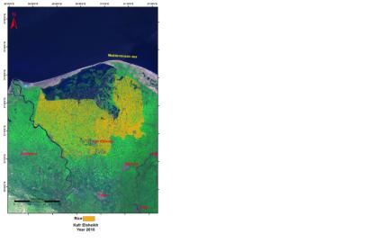
Satellite-based monitoring of rice fields in Egypt

The effects of climate change, population growth and economic development in the Mediterranean are posing a threat to the water supply in the region. As part of ESA’s TIGER initiative, satellite data are supporting water management by identifying water resources. The demand for water is growing around the Mediterranean and is especially crucial in areas that do not receive regular rainfall. This is especially true for the southernmost parts of Europe and the countries lying along the African coast and in the eastern Mediterranean Basin.

Owing to the increasing population, the demand for water is growing for drinking and irrigation, representing 70–80% of the water use in the region. To get a better grip on water management, satellites are increasingly acknowledged as indispensable tools for collecting information on available water resources and their use. This information is also necessary for planning infrastructure, such as where to build a dam, how to divert a waterway or manage a flood event.

The ten-year TIGER initiative exploits Earth observation technologies in order to respond to the urgent need for reliable water information in Africa. TIGER is currently collaborating with the Euro-Mediterranean Information System on Know-How in the Water Sector (EMWIS), organising water observation systems and building capacity in the Mediterranean region.
ESA
Fri, 28 Dec 2012 - 10:31

Footer menu

  • Contact
  • Terms of Use

User account menu

  • Log in