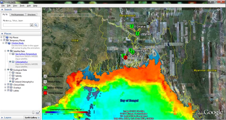
Taking a global view, public health issues and the environment are intimately linked. As an example, research has demonstrated that cholera epidemics occur seasonally in Bangladesh, with peak outbreaks happening twice a year. This bimodal outbreak pattern closely follows the times when large monsoon events are frequent (spring and fall). While these patterns are known, this knowledge alone cannot predict the severity and location of cholera outbreaks until a monsoon event occurs, or an outbreak is reported. Therefore, there can only be reactive responses to cholera outbreaks. A heightened understanding of the link between environmental factors and outbreak occurrence would enhance disease management capabilities. A predictive tool capable of giving better advanced warning of potential outbreaks in specific locations would allow for proactive, preventative responses and minimize negative effects. Remote sensing products can be used to better understand the correlation between outbreak occurrence, sea surface temperature (SST), sea surface height (SSH), salinity, and chlorophyll-a estimates. Using data gathered by NASA SeaWiFS and MODIS sensors, a gridded global image will be developed which will allow for a better understanding of the relationship between the data observed within the context of geographically diverse locations. Temporal observations dating back to 1997 will be used to produce historical maps to elucidate temporal changes in the chosen parameters that can then be related to concurrent public health events. The primary deliverable of this project will be the production of a baseline map using remote sensing data for the pilot design and development of an application to connect Earth science products to water and health studies. The baseline map will demonstrate the inherent value of merging remote sensing data and in-situ observation points for use in forecasting and mitigating disease outbreaks. This effort will build upon current research at University of Maryland, College Park, which focuses on the varying impacts climate has on both water and health. A specific application of this research will be to relate latitude-longitude data with existing points associated with V. cholerae case data collected in Bangladesh.
For more information, please follow the link below to the original article.