• English
  • Español
  • Français

United
Nations


Office for Outer Space Affairs
UN-SPIDER Knowledge Portal

  • Inicio
  • Sobre nosotros
    • Sobre ONU-SPIDER
    • Acerca de UNOOSA
    • Publicaciones
    • Ofertas de trabajo
    • Conozca el Equipo
    • Contacto
  • Aplicación Espacial
    • Guías Tecnológicas
    • Mecanismos de Emergencia
    • Mecanismos de Recuperación
    • Red Internacional de Alerta de Asteroides
    • Grupo Asesor para la Planificación de Misiones Espaciales
    • Iniciativa Internacional sobre Meteorología Espacial
    • Tecnologías Espaciales en la ONU
    • Historias de Usuarios
  • Enlaces y Recursos
    • Aplicación de datos del mes
      • Disaster Recovery
    • Fuentes de Datos
    • SIG y Software de Percepción Remota
    • Recursos de capacitación en línea
    • Instituciones
  • Riesgos y Desastres
    • Gestión del Riesgo de Desastres
    • Alerta temprana
    • Gestión de Desastres y Emergencias
    • Amenazas Naturales
    • El Proceso de la Reducción de Desastres Post-2015
    • La ONU y la Gestión del Riesgo de Desastres
    • La ONU y Alerta Temprana
    • La ONU y la Gestión de Desastres
  • Asesoría
    • Misiones de Asesoría
    • Apoyo en caso de Emergencia
    • Asesoría Virtual
    • Prácticas Recomendadas
    • Actividades de Entrenamiento
    • Usos Prácticos
  • Redes
    • Oficinas Regionales de Apoyo
    • GP-STAR
    • IN-MHEWS
    • IWG-SEM
  • Proyectos
    • SPEAR
    • FOSAT-S
    • EvIDENz
    • Flood GUIDE
  • Noticias y Eventos
    • Noticias
    • Eventos
    • Eventos pasados

Breadcrumb

  • Home
  • DLR Scientists Support Relief Workers In Haiti Earthquake Disaster
  • DLR scientists support relief workers in Haiti earthquake disaster

DLR scientists support relief workers in Haiti earthquake disaster

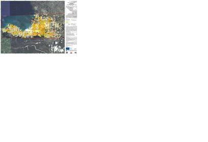
Following the devastating earthquake on Haiti, relief organisations require rapid, reliable and meaningful information on the local situation, the state of the infrastructure and the extent of the damage for their deployment in the disaster zone. In this context, scientists from the German Aerospace Center (Deutsches Zentrum für Luft- und Raumfahrt; DLR) are giving important support by providing free access to maps of the crisis region based on satellite data. At the moment, the researchers are focusing particularly on Port-au-Prince, the capital of the Caribbean island state, which has been particularly badly affected.

Under the 'International Charter on Space and Major Disasters' , ZKI  (Center for Satellite Based Crisis Information; ZKI is a part of DLR, under the umbrella of the German Remote Sensing Data Centre in Oberpfaffenhofen ) makes available satellite data, particularly those from the TerraSAR-X satellite developed and operated by DLR, in crisis situations in Germany and worldwide, analyses satellite data and performs additional functions such as those of the coordinating project manager.

Source: German Aerospace Center

For full article please visit: www.dlr.de/en/desktopdefault.aspx/tabid-1/86_read-22076/
 

Tue, 2 Feb 2010 - 11:00
Haiti

Footer menu

  • Contact
  • Terms of Use

User account menu

  • Log in