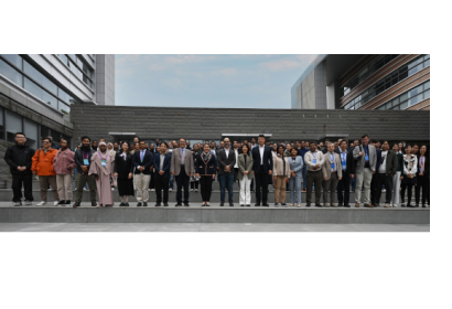
The Training Workshop and Youth Forum on Innovative Geospatial Information Applications for Disaster Resilience and Response was held on 22–23 October 2025 in Deqing and Yuhang, Zhejiang Province, China. UN-SPIDER, the United Nations Economic and Social Commission for Asia and the Pacific (ESCAP), the Regional Centre for Space Science and Technology Education in Asia and the Pacific (RCSSTEAP), the Asia-Pacific Space Cooperation Organization (APSCO), and the United Nations Global Geographic Information Knowledge and Innovation Center (UN-GGKIC) jointly organized the workshop. Held alongside Geospatial Knowledge and Innovation Week (GeoNow) 2025, the forum convened experts, policymakers, and youth representatives to advance geospatial technologies for disaster resilience.
The workshop took place amid the rising frequency and severity of hazard-induced disasters, particularly in the Asia and the Pacific region, which is identified as the world’s most disaster-prone region. Since 1970, more than 2 million lives have been lost to natural hazards in the region, and floods alone have affected more than 3 billion people and caused over $900 billion in economic losses. Participants noted that increased climate-induced disasters, rapid urbanization, and ecosystem degradation exacerbate poverty and inequality. This emphasizes the need for comprehensive disaster risk management approaches, risk-informed development planning, and strengthened multi-hazard early warning systems to reduce vulnerability and enhance community resilience.
Throughout the forum, speakers underscored the essential role of geospatial technologies and Earth observation data in reducing disaster risks and supporting preparedness, response, and recovery efforts. Discussions highlighted how satellite imagery, remote sensing, and digital mapping support disaster impact analysis, enhance national disaster loss accounting, and contribute to the Sendai Framework for Disaster Risk Reduction 2015–2030 and the Sustainable Development Goals (SDGs). The workshop also emphasized the growing importance of artificial intelligence, cloud computing, and large language models in improving monitoring capabilities, supporting anticipatory action, and strengthening evidence-based decision-making for resilience.
A core priority of the event was youth engagement and capacity-building. Young researchers and professionals shared experiences and innovative ideas related to geospatial and digital technologies for disaster risk reduction. The forum connected youth with scientific, technical, and policy communities, encouraging collaboration and strengthening skills to address current and future challenges. Organizers highlighted that empowering the next generation of geospatial leaders aligns with global efforts to promote an equitable and sustainable digital future, including principles reflected in the Global Digital Compact and the Summit of the Future. The event also underscored intergenerational cooperation as a foundation for advancing a global vision for geospatial leadership and resilience.
The workshop supported commitments in the Jakarta Ministerial Declaration on Space Applications for Sustainable Development, particularly advancing geospatial leadership, innovation, and cross-sector cooperation. It provided a platform for experience sharing, networking, and identifying opportunities to strengthen coordination in disaster risk reduction and climate resilience. Participants included postgraduate students from RCSSTEAP and experts in disaster response and mitigation. By fostering knowledge exchange and collaboration between established specialists and emerging professionals, the event contributed to ongoing regional efforts to leverage geospatial technologies for a more resilient and sustainable future.

