Google and the World Resources Institute (WRI) created a new near realtime land cover dataset, called "Dynamic World".
Powered by Google Earth Engine and AI Platform, Dynamic World provides global, near real-time land cover data at a ten-meter resolution, giving high level of detail about what's on the land and how it's being used.
With this information, users can monitor and understand land and ecosystems so they can make more accurate predictions and effective plans to protect our planet in the future.
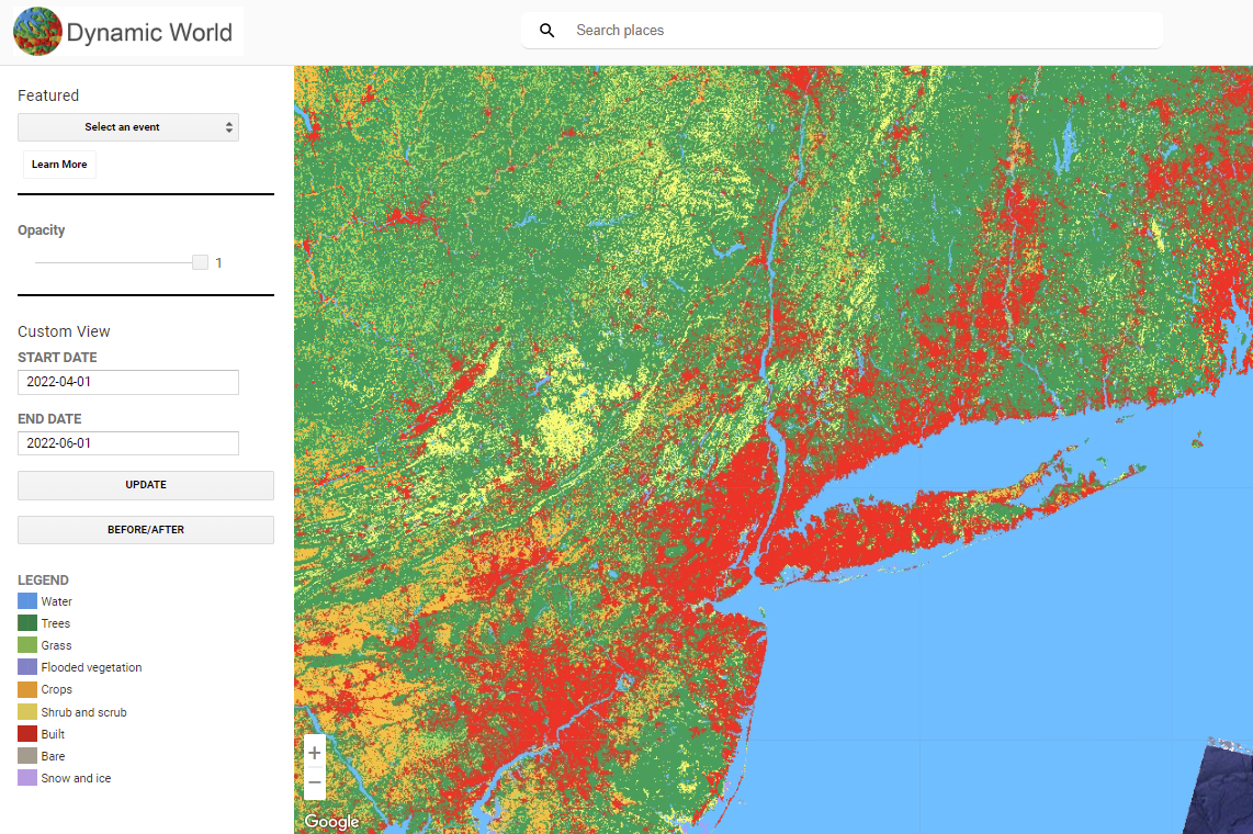
The dataset classifies nine land cover types: water, flooded vegetation, built-up areas, trees, crops, bare ground, grass, shrub/scrub, and snow/ice.
Dynamic World uses Google AI and cloud computing to detect combinations of different land cover types and make conclusions about how likely it is for each of the nine types to be present in every pixel (about 1,100 square feet of land) of a satellite image.
It is one of the largest global-scale land cover datasets produced to date, and is the first of its kind at ten meter resolution in near real-time.
A peer-reviewed paper about Dynamic World has recently been published in Nature Scientific Data.
Explore the data at dynamicworld.app, and access Dynamic World in Google Earth Engine and on Resource Watch.
Image taken from https://www.dynamicworld.app/explore. This dataset is licensed under CC-BY 4.0 and requires the following attribution: "This dataset is produced for the Dynamic World Project by Google in partnership with National Geographic Society and the World Resources Institute." Contains modified Copernicus Sentinel data [2015-present]. See the Sentinel Data Legal Notice.