
The International Centre for Integrated Mountain Development (ICIMOD) is leveraging space-based information to support government and humanitarian agencies in the Hindu Kush Himalayan (HKH) region with timely information for flood early warning and inundation mapping. The efforts, which consist of developing a streamflow prediction system for flood early warning and of providing near real-time flood maps for disaster response, come as the monsoon floods in the region are worsening and compunding the impacts of the COVID-19 pandemic.
Based at ICIMOD, the streamflow prediction system to support flood early warning is being developed through the SERVIR-HKH initiative, which benefits from technical assistance from NASA and the Bringham Young University. The system provides 15-day streamflow predictions estimates using the European Center for Medium Range Weather Forecast’s (ECMWF) runoff predictions. By selecting the appropriate river line from a collection of river networks, users can obtain the 15-day predictions interactively, alongside historical data from 1980 onwards and other information. At the same time, the application has been designed to allow integration into larger decision support systems.
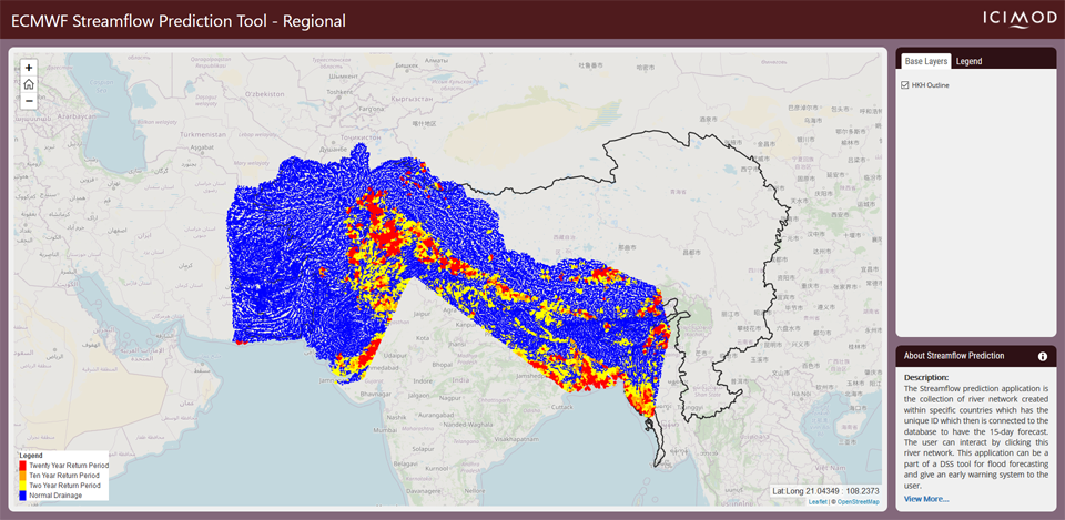
Image: Screenshot of the regional streamflow prediction tool.
A dedicated streamflow prediction system for Nepal has also been developed on the basis of an ensemble weather forecast to provide 48-hour flow predictions based on local rainfall to support flash flood warning. The system is being validated jointly with the Department of Hydrology and Meteorology, Government of Nepal.
In addition to supporting early warning efforts, ICIMOD has also been strengthening flood response activities in the HKH region by providing near real-time inundation maps, for instance for the 2019 floods in Bangladesh. The maps have been created using synthetic-aperture radar (SAR) satellite remote sensing. An online flood mapping application provides easy access to the flood extent layer. Under a NASA Applied Science ProjectICIMOD is currently collaborating with NASA and the University of Alaska Fairbanks to develop an automated flood inundation mapping system.
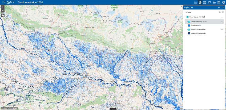
Image: Screenshot of the online flood mapping application.
ICIMOD is one of 24 UN-SPIDER Regional Support Offices. Based in Kathmandu, Nepal, this intergovernmental knowledge and learning centre works in and for its eight regional member countries - Afghanistan, Bangladesh, Bhutan, China, India, Myanmar, Nepal, and Pakistan.