For many studies models are used or developed. During modelling courses not much attention is paid to the preprocessing of input data and parameters needed for the models. A lot of open source software is available for this purpose. Besides desktop tools with graphical user interfaces, scripting is very useful for processing large datasets and timeseries. With the skills learned in this course you will be able to more efficiently process your data and setup and improve your models.
Learning objectives
After this course you will be able to:
Understand the basic concepts of GIS Raster, vector, projections, geospatial analysis. Use a GIS for:
- Thematic mapping
- Basic data processing and editing
- Basic geoprocessing and analysis
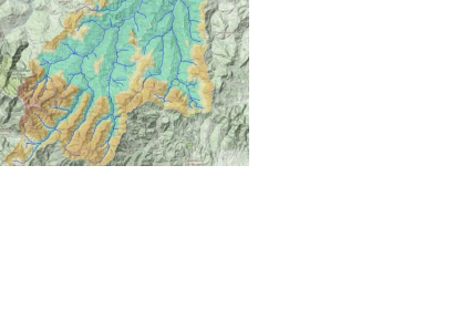
- DEM processing and catchment delineation
- Find open source software and open data
Course Format
| Exercise | Software | Study load (hours) |
| Digitizing from a scanned map | QGIS | 4 |
| Importing tabular data into GIS and interpolation | QGIS | 4 |
| Importing data from a GPS and conversion to vector | QGIS | 4 |
| Spatial planning using map algebra | QGIS | 8 |
| Catchment delineation | QGIS | 8 |
| Using Open Access data | QGIS | 4 |
| Styling and map design | QGIS | 4 |
| Introduction to DOS and GDAL | GDAL | 8 |
References
Software
The free and open source software (FOSS) used in this course are:
- QGIS version 3.4 (newer versions have not been tested)
- GDAL QGIS is a desktop GIS similar to the commercial ArcGIS software. GDAL is the Geodata Abstraction Layer, a set of open source tools that can be used to convert between GIS formats and to reproject data in a standardized way. GDAL commands can also be used in scripts. During the course basic scripting skills will be acquired: shell scripts and the Python programming language.
Books
The following books are suggested to support the course:
- P.A. Burrough, R.A. McDonnell & C.D. Lloyd, Principals of Geographical Information Systems, Oxford University Press, 3rd Edition, 2015
- A. Graser, Learning QGIS Third Edition, Packt Publishing, 2016
- A. Graser & G.N. Peterson, QGIS Map Design - Second Edition, Locate Press, 2018
- K. Menke, Discover QGIS 3.x, Locate Press, 2019