![]()
United
Nations
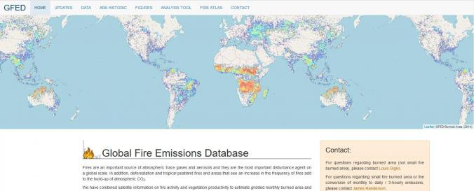
Global Fire Emissions Database (GFED)
| Data provided by: | Global Fire Emissions Database (GFED) |
| Data accessibility: | Exportar datos, Visualización de datos (ej. web SIG o monitoreo en tiempo real), Procesamiento web/computación en la nube |
| Link to the data: | |
| Requirements: | Login for "Burned area (without small fires)" as well as "Daily / 3-hourly emissions" files needed - credentials are given on web page.Annual emissions files and ancillary data can be accessed without login. |
| Data type: | Datos sobre amenazas específicas |
| Hazard: | Forest Fire |
| Disaster cycle phase: | Gestión des Riesgo por Desastres, Respuesta, Recuperación |
| Space-based Information: | Fires are an important source of atmospheric trace gases and aerosols and they are the most important disturbance agent on a global scale. In addition, deforestation and tropical peatland fires and areas that see an increase in the frequency of fires add to the build-up of atmospheric CO2. GFED have combined satellite information on fire activity and vegetation productivity to estimate gridded monthly burned area and fire emissions, as well as scalars that can be used to calculate higher temporal resolution emissions. Most of the resulting datasets are downloadable from this website for use in large-scale atmospheric and biogeochemical studies. The core datasets are: - Burned area - Burned area from "small" fires based on active fire detections outside the burned area maps - Carbon and dry matter emissions - Fractional contributions of various fire types to total emissions - List of emission factors to compute trace gas and aerosol emissions |
| Spatial coverage: | Global |
| Temporal coverage: | Archivado, Casi en tiempo real |
| Costs: | Gratis |
| Contact: | Contact details of GFED |
Provider
![]()