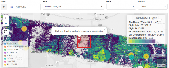
Soil Moisture Visualizer (SMV - ORNL)

| Data provided by: | Oak Ridge National Laboratory (ORNL) |
| Data accessibility: | Exportar datos, Visualización de datos (ej. web SIG o monitoreo en tiempo real) |
| Link to the data: | |
| File type: | csv |
| Data type: | Datos sobre amenazas específicas, Datos sobre el use suelo, cobertura del terreno, Datos satelitales o imágenes aéreas |
| Hazard: | Drought, Mass Movement, Flood, Extreme Temperature |
| Disaster cycle phase: | Gestión des Riesgo por Desastres, Respuesta, Recuperación |
| Spatial coverage: | Northern America |
| Temporal coverage: | Archivado, Casi en tiempo real |
| Costs: | Gratis |
| Tutorials on the use of data: | Soil Moisture Visualizer Guide |
