![]()
United
Nations
Australian Flammability Monitoring System (Bushfire and Natural Hazards CRC)
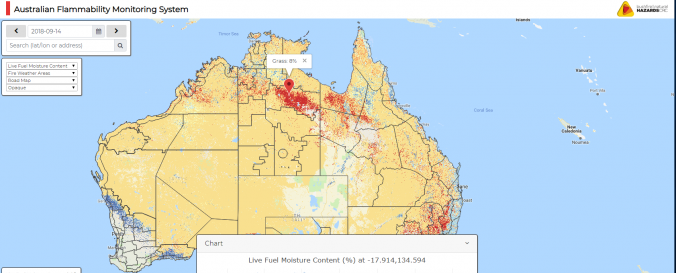
| Data provided by: | Bushfire and Natural Hazards Cooperative Research Center |
| Data accessibility: | Exportar datos, Visualización de datos (ej. web SIG o monitoreo en tiempo real) |
| Link to the data: | |
| File type: | csv |
| Data type: | Datos sobre amenazas específicas |
| Hazard: | Forest Fire, Drought |
| Disaster cycle phase: | Gestión des Riesgo por Desastres |
| Satellites and Sensors: | Terra |
| Spatial coverage: | Australia |
| Spatial resolution: | 500m |
| Temporal coverage: | Casi en tiempo real |
| Content dates: | January 2001 - today |
| Costs: | Gratis |
Provider
![]()