![]()
United
Nations
Flood Monitoring (EOSDIS Worldview - NASA)
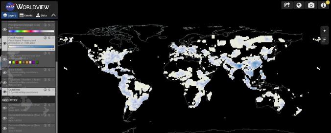
| Data provided by: | National Aeronautics and Space Administration (NASA) |
| Data accessibility: | Exportar datos, Exportar mapa, Visualización de datos (ej. web SIG o monitoreo en tiempo real) |
| Link to the data: | |
| Data type: | Datos sobre amenazas específicas |
| Hazard: | Flood |
| Disaster cycle phase: | Gestión des Riesgo por Desastres, Respuesta, Recuperación |
| Spatial coverage: | Global |
| Technical Specifications: | |
| Costs: | Gratis |
| Tutorials on the use of data: | Look for the "Info" link; then select the "Start Tour" option |
Provider
![]()