United States of America

country taxonomy block

Harvard University organizes a workshop called Remote Sensing for Humanitarian Programs from 26-30 June 2017.

It is a professional training course aimed at providing humanitarian professional basic skills required to use remote sensing technologies, such as satellite and drone imagery, as part of humanitarian operations. The goal of the course is to equip participants with the necessary expertise to manage, design, and utilize remote sensing programs during both natural disasters and conflict-related emergencies.The goal is to equip participants with necessary expertise to manage, design and use remote sensing programs both in the cases of natural disasters and conflict-related emergencies.

The course is conducted by the Signal Program on Human Security and Technology, which is a part of the university's Humanitarian Initiative.The faculty is experienced in remote sensing for humanitarian response and has extensive expertise in satellite data analysis.

The fee is...

more

Defense Strategies Institute, in partnership with the SmallSat Alliance, will host a comprehensive two-day summit on how the application of small satellites is transforming the space domain. Together with government, industry and commercial partners this event will present and highlight the technology currently underway and the challenges that exist in enhancing space access and employing SmallSats to ensure space superiority.

The 2nd annual SmallSat & Space Access Summit encourages members of the DoD, Intelligence Community, military services, and critical organizations to come together to discuss solutions and techniques to exploit the space domain.

Topics to be Covered at the 2019 Summit: 

- Assessing the advantages of employing small satellite capabilities to meet operational requirements

- Leveraging small satellites to gather data and enable the effective monitoring of emerging crises

- Operating micro-satellites in low Earth orbit...

more

Text taken from Google's event page:

"Our Geo for Good Summit is an annual conference intended for nonprofits, scientists and other changemakers who want to leverage technology and use mapping tools (such as Google Earth, Earth Engine, Environmental Insights Explorer, and My Maps) for positive impact in the world.

This year, we are planning to return to an in-person format, but with plenty of online, livestream and virtual elements to allow people not there in-person to connect and learn.

When: October 4-6, 2022
Where: Mountain View, CA, USA (with virtual events too!)

The application deadline to attend the summit in person has already passed, but you can still attend virtually. If you already submitted an application to attend in person, you will be notified of your application decision by July 20, 2022.

If you have any questions, please reach out to...

more

The goal of the Hackaton is to bring together and introduce both non-GEOINT and GEOINT-savvy coders to interesting problems requiring inventive coding solutions. In addition to enabling participation from the non-GEOINT coding world, the end result will be a working code base that performs a specifically requested set of functions or provides answers as outputs.

...

more

The summit will help to find out more about the planned retirement of the North American Datum of 1983 (NAD 83) and the North American Vertical Datum of 1988 (NAVD 88), how this will impact the mapping work, and what tools are planned to ease the transition to new, more accurate datums.

This event will be part of a larger conference organized by the National Society of Professional Surveyors (NSPS) and in partnership with the Management Association for Private Photogrammetric Surveyors (MAPPS). There will be no cost for NGS sessions, but registration is required and space is limited.

This course is the first professional training course with the aim of providing humanitarian professionals basic skills and knowledge required to use remote sensing technologies, such as satellite and drone imagery, as part of humanitarian operations. The goal of the course is to equip participants with the necessary expertise to manage, design, and utilize remote sensing programs during both natural disasters and conflict-related emergencies.

The Remote Sensing Workshop for Humanitarian Response is a five-day training conducted by the Signal Program on Human Security and Technology at the Harvard Humanitarian Initiative. The course faculty is experienced in remote sensing for humanitarian response, and has extensive expertise in analyzing data from both satellites and from unmanned aerial vehicles (UAVs) in real-world-situations. 

Course Objectives

At the end of this course the participant will be able to:

    ...
more

This conference merges up to three unique satellite conferences into one major event. It has been the practice of the American Meteorological Society (AMS) Satellite Meteorology, Oceanography, and Climatology (SatMetOC) Committee (organizers of the 23rd AMS Satellite Meteorology, Oceanography and Climatology Conference) and the European Organisation for the Exploitation of Meteorological Satellites (EUMETSAT; organizers of the 2019 EUMETSAT Meteorological Satellite Conference) to hold joint conferences approximately every six years, most recently in Vienna (2013), and previously in Amsterdam (2007) and Paris (1998).

Major areas of interest: 
  1. New Satellite Systems and Instrumentation—illustrating the potential of new satellite systems to improve weather, climate, and other environmental data products; enhance user application and services, and contribute to blended and fused satellite datasets; future observing system architectures, flight projects,...

more

Consists of:

  • Heat & Fire Expo
    • "The Heat & Fire USA is the leading wildfire prep, management, and recovery event, showcasing the latest tools, strategies, and insights among investment and global industry leaders."
  • Earthquake Expo
    • "The Earthquake Expo USA is the leading seismic prep, management, and recovery event, showcasing the latest tools, strategies, and insights among investment and global industry leaders."
  • Flood Expo
    • "The Flood Expo USA is the leading flood prep, management, and recovery event, showcasing the latest tools, strategies, and insights among investment and global industry leaders."
  • ...
more

The International Conference of Crisis Mappers (ICCM) is the leading humanitarian technology event of the year, bringing together the most important humanitarian, human rights, development and media organizations with the world's best technology companies, software developers and academics. As thus one of the few neutral spaces where such important conversations can take place, the annual ICCM conference brings together a wide range of diverse actors for important conversations that lead to concrete new projects and deliverables across a variety of diverse domains. As a community of practice, the ICCM thus helps facilitate new projects and catalyzes innovation in the area of humanitarian technology.

The theme for this year's event, Affected Communities in Spotlight, will focus on better engaging and understanding populations as the primary referent during a disaster.

more

The Open Geospatial Consortium (OGC®) invites attendance at the June 2015 OGC Technical Committee Meeting be held at UCAR/NCAR Center Green in Boulder, Colorado 1 June to 5 June, 2015. In addition to a rich agenda of Working Group meetings and special events, there will be a dinner reception and Gardels Award announcement on Wednesday evening at the NCAR/UCAR Mesa Laboratory.

The week’s special events include the final OGC Testbed 11 Demonstration plus: a Point Cloud Ad Hoc meeting, a Geospatial/BIM/Indoor Location Workshop (“GIS BIM” in the TC agenda), a Water Data Summit, and a GeoSemantics Summit. 

OGC Domain Working Groups...

more

The application of Earth Observation (EO) datasets for Sustainable Development is a fast-growing field. EO innovations are contributing to the delivery of economic and societal benefit to developing countries, helping them meet their Sustainable Development Goals. There is great potential to build on the unique strengths that the space sector has to deliver sustainable development objectives, especially in data-sparse regions. In developing nations, where there is a need to bridge the gap between existing technologies and operational applications, EO technology can enhance the capability to monitor the Earth’s vital resources, and to support planning, design, operation, and management processes of various sectors.

more

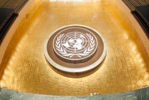
Convened by the President of the General Assembly, the High-Level Meeting of the General Assembly on the Midterm Review of the implementation of the Sendai Framework for Disaster Risk Reduction 2015-2030 (HLM) will take place from 18-19 May 2023 at the United Nations Headquarters in New York.

The HLM provides a platform for Member States, the United Nations system partners and other stakeholders to reflect on the findings and recommendations of the Midterm Review, to examine context shifts and emerging issues since 2015, and identify course corrections and new initiatives to more effectively address the systemic nature of risk, and realize the outcomes and goals of the Sendai Framework, the 2030 Agenda for Sustainable Development, the Paris Agreement and other agreements, frameworks and conventions.

High-Level Meeting Objectives

The HLM is expected to:

  • Raise global awareness and generate political will and momentum to...
more

The Humanitarian UAV Network (UAViators) is proud to partner with Unmanned Experts (UMEX) to offer another hands-on dedicated course on UAV missions for humanitarian and development professionals. The mission of UAViators is to promote the safe, coordinated and effective use of UAVs in a wide range of humanitarian and development settings. Offering and co-teaching hands-on training courses in partnership with leading UAV experts is integral to furthering this mission. Unmanned Experts is a team of trainers, consultants, researchers and pilots with over 25,000 hours of unmanned flight time and 35,000 hours in manned aircraft. A leader in UAV training and operations, UMEX is excited to apply their experience and expertise to helping in times of need and assisting aid organizations become smart consumers of UAV services.

The 3-day professional course will take place just outside of Washington DC on...

more

Society is increasingly exposed and vulnerable to frequent reoccurrence of natural disasters exacerbated by climate change. In the event of a disaster, there is huge amount of heterogenous data generated by the people and automated systems. For instance, social network data generated by citizens and first responders, satellite images of the affected areas, flood maps generated by drones. This has become a huge global issue that needs to be addressed. To convert this massive heterogenous crisis data into valuable knowledge, there is need to integrate it and extract knowledge in near-real time by means of novel data analytics solutions. Although, currently the analysis is focused on one single type of data (e.g social media, or satellite images).Their integration into big data analytics systems capable of building accurate predictive now cast and forecast models will provide effective support for emergency management.

The workshop aims at involving researchers, practitioners...

more

This training course provides humanitarian professionals the basic skills and knowledge required to use remote sensing technologies, such as satellites and drone imagery as well as GIS fundamentals, as part of humanitarian operations. 

At the end of this course the participant will be able to:

  • Understand how satellites and drones are used in humanitarian response.
  • Apply geospatial data to specific humanitarian activities. 
  • Develop geospatial collection and analysis plans for emergencies.
  • Explore the ethical and regulatory issues related to these technologies.
Remote Sensing Workshop

The Remote Sensing Workshop for Humanitarian Response is a five-day training conducted by the Signal Program on Human Security and Technology at the Harvard Humanitarian Initiative. The goal of the course is to equip participants with the necessary expertise to manage, design, and utilize remote sensing programs during both natural...

more

The International Conference on Flood Management (ICFM) offers an international conference platform, hosted every 3 years, to discuss a range of flood related issues and realize significant change in a multidisciplinary, multi-sectoral area. ICFM8 aims at providing a unique opportunity to exchange ideas and experiences on a range of issues that affect flood management, particularly the need to build resilience into future planning.  The conference will identify key concerns and significant challenges of the future as currently perceived by researchers, industry, policymakers and other flood management stakeholders.

Main Conference Themes

  • Science & Technology for Flood Risk Management
  • Handling Data and Information for Flood Risk Management
  • Flood Disaster Prevention, Mitigation, and Adaptation
  • Flood Preparedness, Response, and Recovery
  • Flood Decision-making, Policy, and Governance
  • Flood Resilience...
more

The Summit is a high-level event, bringing world leaders together to forge a new international consensus on how we deliver a better present and safeguard the future.

Effective global cooperation is increasingly critical to our survival but difficult to achieve in an atmosphere of mistrust, using outdated structures that no longer reflect today’s political and economic realities.

This once-in-a-generation opportunity serves as a moment to mend eroded trust and demonstrate that international cooperation can effectively achieve agreed goals and tackle emerging threats and opportunities.

In September, world leaders will convene at the United Nations to adopt the Pact for the Future, which will include a Global Digital Compact and a...

more

Satellite Innovation 2018 has emerged as the premier meeting place for innovative Satellite Executives and Professionals. A focus on imminent changes and market forces that will guide their implementation has attracted a confluence of established market leaders and pioneers of the shifting landscape of SatCom.