![]()
United
Nations
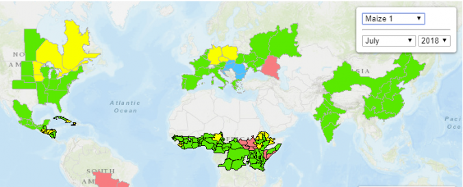
Crop monitoring - GEOGLAM (GEO)
| Data provided by: | United States Geological Survey (USGS) |
| Data accessibility: | Exportar datos, Visualización de datos (ej. web SIG o monitoreo en tiempo real) |
| Link to the data: | |
| Requirements: | Registration and login. Here you go |
| Data type: | Datos sobre amenazas específicas |
| Hazard: | Drought |
| Disaster cycle phase: | Gestión des Riesgo por Desastres |
| Spatial coverage: | Global |
| Spatial resolution: | 30 - 100 |
| Temporal coverage: | Archivado, Casi en tiempo real |
| Content dates: | 1999 - today |
| Technical Specifications: | |
| Costs: | Gratis |
| Tutorials on the use of data: | Recommended Practice by ISA on using MODIS GLAM NDVIDB for drought monitoring, How to download GEOGLAM data from Earth Explorer |
| Restrictions/ Citation of the dataset: |
Provider
![]()