![]()
United
Nations
GDACS - Map of disaster alerts in the past 4 days
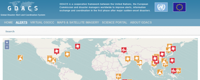
| Data provided by: | UNITAR Operational Satellite Applications Programme (UNOSAT), United Nations Office for the Coordination of Humanitarian Affairs (OCHA) |
| Data accessibility: | Visualización de datos (ej. web SIG o monitoreo en tiempo real) |
| Data type: | Datos sobre amenazas específicas |
| Hazard: | Earthquake, Flood, Forest Fire, Severe Storm, Tsunami, Volcanic Eruption |
| Disaster cycle phase: | Gestión des Riesgo por Desastres, Respuesta, Recuperación |
| Space-based Information: | Derived products from various satellites processed by agencies in the field of disaster mapping. |
| Spatial coverage: | Global |
| Temporal coverage: | Casi en tiempo real |
| Costs: | Gratis |
| Restrictions/ Citation of the dataset: |
Provider
![]()