Temperature extrema
Definition
Facts and figures
Further information
UN-SPIDER Regional Support Offices with hazard-specific expertise
Related content on the Knowledge Portal
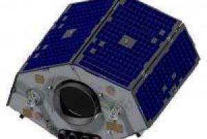
VRSS-1 is Venezuela's first remote sensing satellite.
read more
On May 26, 2011, a contract for the manufacture and launch of the VRSS-1 spacecraft was signed in Caracas, Venezuela, between the government of Venezuela (the Ministry of People’s Power for Science, Technology and Intermediate Industries) and CGWIC (China Great Wall Industry Corporation), a subsidiary of CASC (China Aerospace Science & Technology Corporation).
After launch, the VRSS-1 satellite was renamed in honor of Sebastián Francisco de Miranda (1750-1816), a Venezuelan revolutionary hero, known as ‘Generalissimo’ Francisco de Miranda, who had planned the independence of the Spanish colonies in South America.
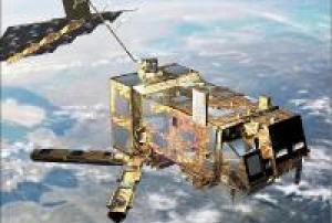
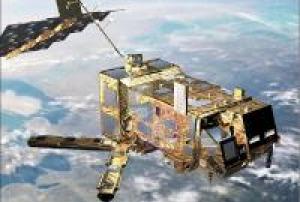
Partner organizations in the VRSS-1 program: ABAE is the Space Agency of Venezuela, subordinated and funded by the Venezuelan Ministry of People’s Power for Science, Technology and Innovation (MPPCTI). ABAE is in charge of in-orbit operations, management and application of...20/09/2012METOP (Meteorological Operational) is Europe's first polar-orbiting operational meteorological satellite. It is the European contribution to the Initial Joint Polar System (IJPS), a co-operative agreement between Eumetsat and the US National Oceanic and Atmospheric Administration (NOAA) to provide data for climate and environmental monitoring and improved weather forecasting.
Metop-A (launched on 19 October 2006), Metop-B (launched on 17 September 2012) and Metop-C (launched 7 November 2018) are in a lower polar orbit, at an altitude of 817 kilometres, to provide more detailed observations of the global atmosphere, oceans and continents. The three satellites will operate in unison for as long as Metop-A's available capacities bring benefits to users. NOAA still continues to operate its mid-afternoon orbit satellite service as part of the Polar Orbit Enviromental Satellites (POES) system.Instruments:
read more
A/DCS (Advanced Data Collection System)...17/09/2012Today, weather satellites scan the whole Earth, meaning not a single tropical storm or severe weather system goes undetected. The early detection and warnings they provide have saved thousands of lives.
Meteosat data is of unique value to nowcasting of high impact weather in support of safety of life and property.
It has been shown to improve weather forecasts and severe weather warnings which, in turn helps limit damage to property and benefits industry e.g. transport, agriculture and energy.
Meteosat-10 provides the Rapid Scanning Service, delivering more frequent images every five minutes over parts of Europe, Africa and adjacent seas. It also provides Search and Rescue monitoring.Instruments:
read more
GERB (Geostationary Earth Radiation Budget)
MSG Comms (Communications Package for MSG)
SEVIRI (Spinning Enhanced Visible and Infra-Red Imager)
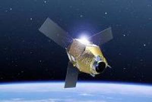
05/07/2012Launched in December 2011, Pleiades is a constellation of two very-high-resolution satellites capable of acquiring imagery of any point on the globe in under 24 hours for civil and military users.
read more
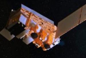
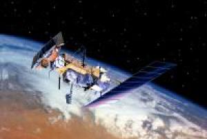
Pleiades has been observing and mapping Earth’s surface at a resolution of just 70 cm every day since December 2011. Comprising the Pleiades 1A and Pleiades 1B satellites, this space imaging system complements the capabilities of the SPOT satellites, which have a wider field of view than Pleiades but lower spatial resolution. What’s more, as Pleiades 1A and 1B are in the same orbit, together they can image anywhere on Earth in less than 24 hours. Pleiades imagery is used for both civil and military applications, for example to track urban expansion, monitor the planet’s active volcanoes or assist road and railway routing, and to locate adversaries’ military installations for mission planning. Pleiades’ key asset is an extremely sensitive optical...17/12/2011The NPOESS Preparatory Project (NPP) was renamed to Suomi National Polar-orbiting Partnership (Suomi NPP) in honor of Verner E. Suomi, University of Wisconsin meteorologist, widely recognized as the "Father of Satellite Meteorology."
Launched from California’s Vandenberg Air Force Base a board a Delta-II Mission Launch Vehicle in October 2011, Suomi NPP is the predecessor to the JPSS series spacecraft and is considered the bridge between NOAA's legacy polar satellite fleet, NASA's Earth observing missions and the JPSS constellation. Suomi NPP was constructed with a design life of five years (although it’s still functioning normally).and carries five state-of-the-art instruments: (1) VIIRS, (2) CrIS, (3) ATMS, (4) OMPS, and (5) CERES FM5.
Instruments:
read more
VIIRS (Visible/Infrared Imager and Radiometer Suite)
CrIS (Cross Track Infrared Sounder)
ATMS (Advanced Technology Microwave Sounder)
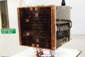
OMPS (...28/10/2011NASRDA (National Space Research & Development Agency) of Abuja, Nigeria has continued its association with SSTL, with two parallel projects - the NX and NigeriaSat-2. Like NigeriaSat-1, NX is based on the SSTL-100, but is being developed by a team of 26 Nigerian trainee engineers at SSTL's facilities in England. The Nigerian engineers will completely manage the total lifecycle of the NX and will be responsible for the delivery of the satellite to full flight specification.
read more
Capacity building is central to the implementation of the Nigeria Space Program. As part of the Know-How Technology Training (KHTT) on the NigeriaSat-2 satellite project is the development of a training model (TM) named NigeriaSat-X. The TM will be used to give the KHTT’s hands on experience in the requirements specification, project management, system engineering, manufacture, test, assembly / integration and final system testing of a spacecraft. Unlike the...17/08/2011In November 2006, NASRDA (National Space Research and Development Agency) of Abuja, Nigeria awarded a contract to SSTL (Surrey Satellite Technology Ltd.) of Guildford, UK, to develop and build NigeriaSat-2, including the related ground infrastructure and image processing facilities, together with an extensive training program to further develop an indigenous space capability in the Federal Republic of Nigeria. NASRDA is an agency under the Federal Ministry of Science and Technology of Nigeria established in 1999.
read more
The objective of the NigeriaSat-2 mission is to provide high-resolution (Pan and MS) imagery in a swath width of 20 km. In addition, the spacecraft also carries a DMC continuity payload to provide observation continuity with NigeriaSat-1, launched in September 2003. - The imagery of both spacecraft will serve as a catalyst to the development of Nigeria's NGDI (National Geospatial Data Infrastructure) program. NASRDA will facilitate efficient production, management...17/08/2011GOES 15 (GOES-P) is an American weather satellite, which will form part of the Geostationary Operational Environmental Satellite (GOES) system operated by the US National Oceanic and Atmospheric Administration. The spacecraft was constructed by Boeing, and is the last of three GOES satellites to be based on the BSS-601 bus. In addition to weather forecasting on Earth, a key instrument onboard GOES-P, the Solar X-Ray Imager (SXI), will help NOAA continue monitoring solar conditions.
Instruments:
read more
GEOS&R (Geostationary Search and Rescue)
SEM/MAG (SEM / Magnetometer)
SOUNDER (GOES Sounder)
SXI (Solar X-ray Imager)
SEM/EPS (SEM / Energetic Particles Sensor)
SEM/HEPAD (SEM / High Energy Proton and Alpha Particles Detector)
SEM/XRS-EUV (SEM / X-Ray Sensor - Extreme Ultra-Violet Sensor)
DCIS (Data Collection and Interrogation Service)
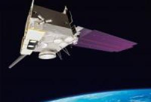
IMAGER (GOES Imager)04/03/2010NOAA-19, designated NOAA-N' (NOAA-N Prime) prior to launch, is the last of the United States National Oceanic and Atmospheric Administration's POES series of weather satellites. NOAA-19 was launched on February 6, 2009.
On November 4, 2008, NASA announced that the satellite had arrived at Vandenberg aboard a C-5 Galaxy military transport aircraft. Installation of the payload fairing took place January 27, 2009; second stage propellant was loaded on January 31.
Several attempts were made to conduct the launch. The first attempt was scrubbed after a failure was detected in a launch pad gaseous nitrogen pressurization system. The second attempt was scrubbed after the failure of a payload fairing air conditioning compressor, which is also part of the ground support equipment at the launch pad.
The satellite was successfully launched at about 2:22 a.m. PST. February 6, 2009 aboard a Delta II flying in...
read more06/02/2009METOP (Meteorological Operational) is Europe's first polar-orbiting operational meteorological satellite. It is the European contribution to the Initial Joint Polar System (IJPS), a co-operative agreement between Eumetsat and the US National Oceanic and Atmospheric Administration (NOAA) to provide data for climate and environmental monitoring and improved weather forecasting. The first MetOp-A satellite was launched in 2006, with the other two following at five-year intervals. In total, the programmes will be operational for at least 14 years.
read more
Launched in October 2006, MetOp-A, the first satellite in the series of three, replaced one of two satellite services operated by NOAA and is Europe’s first polar-orbiting satellite dedicated to operational meteorology. Once operational in orbit, responsibilities for the meteorological satellite services have been shared between the USA and Europe.
The MetOp satellites are designed to work in conjunction with the NOAA...19/10/2006


