![]()
United
Nations
Incendio
, processed by ESA, CC BY-SA 3.0 IGO.")
Definition
Facts and figures
Further information
UN-SPIDER Regional Support Offices with hazard-specific expertise
Related content on the Knowledge Portal
KOMPSAT-2 (Korea Multi-Purpose Satellite-2), also referred to as Arirang-2 by South Korea, has been developed by KARI (Korea Aerospace Research Institute) to continue the observation program of the KOMPSAT-1 mission.
The main mission objectives of the KOMPSAT-2 system are to provide a surveillance of large scale disasters and its countermeasure, acquisition of independent high resolution images for GIS (Geographic Information Systems), composition of printed maps and digitized maps for domestic and overseas territories, balanced development of Korean territories, survey of natural resources, and continuation of satellite earth observation after KOMPSAT-1.
Instrument: MSC (Multispectral Camera)
- resolution: 1m panchromatic, 4m multispectral
- swath width: approx. 15km
read more28/07/2006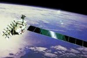
ALOS (Advanced Land Observation Satellite) has been decommissioned. ALOS was successfully launched on January 24, 2006 from the Tanegashima Space Center.
ALOS was one of the world's largest earth observation satellites whose function is to collect global and high resolution land observation data. ALOS data was made available at conditions similar to those of ERS and Envisat missions, namely for scientific 'Category-1' use as well as commercial applications.
The ALOS (renamed "Daichi") satellite sensor had three remote-sensing instruments: the Panchromatic Remote-sensing Instrument for Stereo Mapping (PRISM) and for digital elevation models (DEMs). The Advanced Visible and Near Infrared Radiometer type 2 (AVNIR-2) for precise land coverage observation, and the Phased Array type L-band Synthetic Aperture Radar (PALSAR) for day-and-night and all-weather land observation and enabled...
read more24/01/2006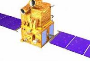
Cartosat-1 satellite sensor was built by ISRO (Indian Space Research Organization) which is mainly intended for cartographic applications was launched by the PSLV on May 5, 2005 at Sriharikota, India.
Prior to launch, ISRO renamed the IRS-P5 spacecraft to CartoSat-1, to describe more aptly the application spectrum of its observation data. In this mission, the high resolution of the data (2.5 m GSD) is being traded at the expense of multispectral capability and smaller area coverage, with a swath width of 30 km. The data products are intended to be used in DTM (Digital Terrain Model)/DEM (Digital Elevation Model) generation in such applications as cadastral mapping and updating, land use as well as other GIS applications.Instrument: PAN (Panchromatic Camera)
- high resolution optical imager
- max swath: 30km05/05/2005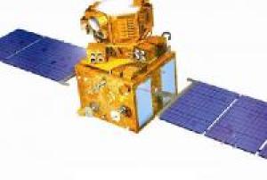
IRS-P6 is an Earth observation mission within the IRS (Indian Remote-Sensing Satellite) series of ISRO (Indian Space Research Organization), Bangalore, India. The overall objectives of the IRS-P6 mission (ResourceSat-1) are to provide continued remote sensing data services on an operational basis for integrated land and water resources management. IRS-P6 is the continuation of the IRS-1C/1D missions with considerably enhanced capabilities.
Prior to launch, ISRO renamed the IRS-P6 spacecraft to ResourceSat-1, to describe more aptly the application spectrum of its observation data.
Instruments:
LISS-4 (Linear Imaging Self-Scanning Sensor-4)
LISS-3 (Linear Imaging Self-Scanning Sensor-3)
AWiFS (Advanced Wide Field Sensor)17/10/2003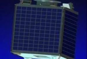
On 26 September 2003 Nigeria launched its $13 million national satellite NigeriaSat-1 in Plesetsk, Russia under a seven-nation constellation being handled by a Russian firm, Cosmos. Nigeriasat-1 is a low earth orbit micro satellite for disaster monitoring looking spacecraft, 5-year target design life-span orbit 700km. The launching of the National Satellite, which started development in November 2001, had been postponed from July 2003 because the Russian Space Agency had to launch a military satellite during that period. NigeriaSat-1 is one of five satellites which will make up a network called the Disaster Monitoring Constellation. The other partners in the international consortium are UK, China, Algeria, Turkey, Thailand and Vietnam. Each satellite belongs to one country, but they will share information with each other when disaster monitoring is needed. The Disaster Monitoring Constellation satellites, which cost less than $10 million each, are built by a British-based company,...
read more27/09/2003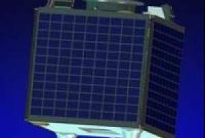
BNSCSat (British National Space Centre Satellite) or UK-DMC 1 is the UK component of DMC. The Disaster Monitoring Constellation (DMC) is an international programme initially proposed in 1996 and led by SSTL (Surrey Satellite Technology Ltd) from the United Kingdom, to construct a network of five affordable Low Earth Orbit (LEO) microsatellites. The objective is to provide a daily global imaging capability at medium resolution (30-40 m), in 3-4 spectral bands, for rapid-response disaster monitoring and mitigation. The Disaster Monitoring Constellation (DMC) is a novel international co-operation in space, led by SSTL bringing together organisations from seven countries: Algeria, China, Nigeria, Thailand, Turkey, the United Kingdom and Vietnam. The DMC Consortium is forming the first-ever microsatellite constellation bringing remarkable Earth observation capabilities both nationally to the individual satellite owners, and internationally to benefit world-wide humanitarian aid...
read more27/09/2003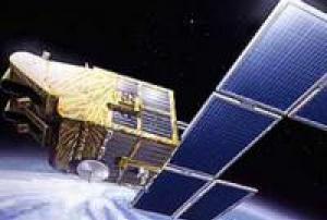
The satellites SPOT 5 (Satellite Probatoire de l'Observation de la Terre) was a third generation of SPOT earth observation satellite operated by Spot Image.
SPOT 5 used the improved SPOT Mk.3 bus design.
The prime imaging instrument was HRG (High Resolution Geometric), which was built by Astrium SAS of Vélizy, France to continue to improve the HRVIR service of SPOT-4. Two HRG instruments are provided in the conventional SPOT-series double-observation configuration, each with a FOV of 4.13º and the same cross-track pointing capabilities of ±27 º as the HRVIR imager on SPOT-4. The observation coverage of each HRG is 60 km in the nadir direction and >80 km in the oblique configuration.
SPOT-5 carries also the HRS (High Resolution Stereoscopic) instrument, which was developed and built by EADS Astrium SAS, sponsored by CNES and SPOT IMAGE. The objective of this instrument is to provide large-area along-track stereoscopic panchromatic imagery...
read more04/05/2002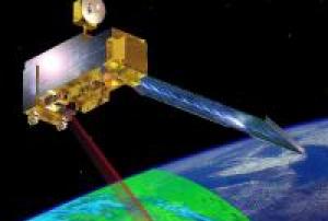
Terra explores the connections between Earth's atmosphere, land, snow and ice, ocean, and energy balance to understand Earth's climate and climate change and to map the impact of human activity and natural disasters on communities and ecosystems. It was launched on 18 December 1999 and has far exceeded its design life, having a strong chance of operating successfullty into the early 2020s.
Terra is in a circular sun-synchronous polar orbit that takes it from north to south (on the daylight side of the Earth) every 99 minutes.On October 6, 2018 Terra completed 100,000 orbits around Earth.
Approximately the size of a small school bus, the Terra satellite carries five instruments that take coincident measurements of the Earth system.
Instruments:
read more
Advanced Spaceborne Thermal Emission and Reflection Radiometer (ASTER): Creates high resolution images of water, ice, clouds and the land surface using Shortwave Infrared...18/12/1999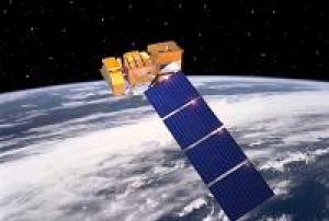
The government-owned Landsat 7 was successfully launched on April 15, 1999, from the Western Test Range of Vandenberg Air Force Base, California, on a Delta-II expendable launch vehicle. The Earth observing instrument on Landsat 7, the Enhanced Thematic Mapper Plus (ETM+), replicates the capabilities of the highly successful Thematic Mapper instruments on Landsats 4 and 5.
read more
Landsat 7 is the most accurately calibrated Earth-observing satellite, i.e., its measurements are extremely accurate when compared to the same measurements made on the ground. Landsat 7’s sensor has been called “the most stable, best characterized Earth observation instrument ever placed in orbit.” Landsat 7’s rigorous calibration standards have made it the validation choice for many coarse-resolution sensors.
Considered a calibration-triumph, the Landsat 7 mission went flawlessly until May 2003 when a hardware component failure left...15/04/1999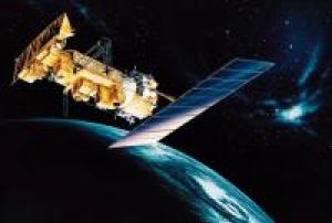
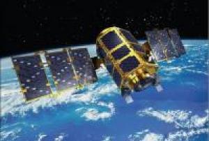
NOAA-15 (designated NOAA-K before launch) is one of the NASA-provided TIROS series of weather forecasting satellite run by NOAA. It was launched on May 13, 1998, and is currently operational, in a sun-synchronous orbit, 807 km above the Earth, orbiting every 101 minutes. It hosts the AMSU-A and AMSU-B instruments, the AVHRR and High Resolution Infrared Radiation Sounder (HIRS/3) instruments, as well as a Space Environment Monitor (SEM/2).
Instruments:
read more
AMSU-A (Advanced Microwave Sounding Unit - A)
AMSU-B (Advanced Microwave Sounding Unit - B)
AVHRR/3 (Advanced Very High Resolution Radiometer/3)
HIRS/3 (High Resolution Infra Red Sounder/3)
S&RSAT (Search & Rescue Satellite-Aided Tracking System)
DCS/s (Data Collection System/2)
SEM/MEPED (SEM/Medium energy proton detector)
SEM/...13/05/1998
Term Parents
UN-SPIDER Regional Support Offices with hazard-specific expertise
![]()