Assessing potential use of water resources in an African river basin

This is event is available for participation on an ongoing basis

The online course "Assessing potential use of water resources in an African river basin" organised by EO Africa - Research and Development Facility, aims to teach participants how to relate water balance components (precipitation, evaporation, run-off and groundwater recharge) to identify surpluses of water and possible potential usage of those water resources in the area.

0
0
No certificate issued or not known
0.00
USD
05/15/2023, 12:00am - 06/09/2023, 12:00am
not visible
1

SUPARCO: National Workshop on Natural Catastrophe Modeling (NatCat Model)

The Space and Upper Atmosphere Research Commission (SUPARCO) of Pakistan, Regional Support Office to UN-SPIDER, is presently undertaking the “Development of Geo-referenced Exposure Database for Catastrophe (NatCat Model)” Project for National Disaster Risk Management Fund (NDRMF). Main components of the project include; floods, droughts, earthquakes and cyclones probabilistic hazard assessment, exposure and vulnerability assessment, financial risk assessment and development of a spatial database and Web Portal.

Launch of the DRR Network of Centers of Excellence in Africa

The United Nations Office for Disaster Risk Reduction (UNDRR) gathered inter-governmental bodies, academia, practitioners, and scientists on 8 March 2023 to establish and launch the Africa Network of Centres of Excellence for Disaster Risk Reduction (NoE). The NoE will function as a framework for members and institutions to collaboratively develop, deliver, and share customized tools, services, products, and training for Disaster Risk Management (DRM); all guided by user needs in Africa.

Risk-KAN Webinar: Improving warning systems through community action

This event is available for participation on an ongoing basis.

Early Warning Systems play a crucial role in decreasing the mortality rates triggered by disasters, and global monitoring systems, standards for a range of warning-related activities and alerts, agreements and partnerships support them. Nevertheless, despite numerous advances, hazards continue to trigger significant social and economic losses, particularly in developing countries, and the warnings are still often characterized by failure.

0
0
No certificate issued or not known
0.00
USD
03/29/2023, 12:00am
not visible

Risk-KAN (Knowledge Action Network on Emergent Risks and Extrem Events)

1
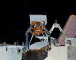
NASA's Innovative Weather Sensors Employed for Tracking Tropical Cyclones

NASA has developed two weather instruments known as COWVR (Compact Ocean Wind Vector Radiometer) and TEMPEST (Temporal Experiment for Storms and Tropical Systems) to test the potential of low-cost sensors in weather forecasting. The instruments have exceeded expectations and deliver useful forecast information, particularly for tropical cyclones.

deniz.maktav Fri, 17 Mar 2023 - 23:13

New NASA-led Study Proves Strong Link between Global Warming and Worldwide Intensity of Extreme Wet and Dry Events

Although scientists have predicted that extreme wet and dry events will become more frequent and severe as the planet warms and climate changes, detecting this on regional and continental levels have been difficult to prove.

Monitoring Vegetation Dynamics from Space

This is event is available for participation on an ongoing basis

EO Africa Research & Development Facility is offering an online training course from April 3 to April 28. Participants will explore the potential of temporal dimension satellite EO data for monitoring vegetation dynamics and land cover/land use changes over long periods. The course involves theoretical concepts of hyper-temporal monitoring and practical skills in acquiring, pre-processing and analysing long-time series of satellite EO data. 

Upon completion of the course, participants will be able to:

0
0
Only applicants working for an African-based organization are eligible.
No certificate issued or not known
0.00
USD
04/03/2023, 12:00am - 04/28/2023, 12:00am
not visible
1

NASA Launched Flooding Analysis Tool

Heavy rains, sea level rise, flash floods, and coastal floods are expected to increase further the frequency and severity around the coastal areas of the United States. Since 2000, at least one flood has occurred in the U.S. on average on nearly 300 days per year. The NOAA database also shows that all 50 states and the District of Columbia were affected by flooding in 2021.

NOAA Satellites Play Crucial Role in Preparing for Severe Weather

As the arrival of spring increases the risk of severe weather, NOAA's geostationary and polar-orbiting satellites, such as GOES East, GOES West, Suomi NPP, and NOAA-20, are closely monitoring the changing weather patterns.

IPCC will launch the last documents of its Sixth Assessment Report on 20 March 2023

On Monday, 13 March 2023, the Intergovernmental Panel on Climate Change (IPCC) opened its 58th session to complete the last elements of its Sixth Assessment Report: the Synthesis Report and its Summary for Policymakers. The session takes place in Interlaken, Switzerland, and is scheduled to run until 17 March.