![]()
United
Nations
Forest Fire
, processed by ESA, CC BY-SA 3.0 IGO.")
Definition
Facts and figures
Further information
UN-SPIDER Regional Support Offices with hazard-specific expertise
Related content on the Knowledge Portal

Southern Africa is exposed to hydrometeorological, geological, coastal and biological hazards. The region has been hard hit by droughts in recent years. Tropical cyclone Idai triggered massive floods in Mozambique, Malawi, and Zimbabwe in March 2019, and in 2020 several countries experience a severe locust outbreak. And unfortunately, COVID-19 continues to impact all countries in this region.
To continue efforts to promote the use of space technologies in disaster risk management, emergency response and recovery efforts, UN-SPIDER and the Centre for Remote Sensing of Land Surfaces of the University of Bonn (ZFL) joined forces to organize the UN-SPIDER / ZFL Regional Virtual Expert Meeting for Southern Africa "Space-based Solutions for Disaster Risk Management and Emergency Response" from 13 to 15 July 2021. This regional expert meeting contributed to the efforts conducted by UN-SPIDER on disaster risk reduction, preparedness, early warning…
read moreRegional Support Offices mentioned:19/07/2021
 Publishing institution:
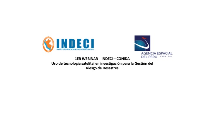
Like many countries in Latin America, Peru is exposed to a variety of natural hazards that have triggered disasters in previous decades. Disaster preparedness, response and recovery efforts are coordinated by the National Civil Defense Institute (INDECI). In recent years, INDECI has benefited from the advisory support provided by Peru’s National Commission for Aerospace Research and Development (CONIDA). Taking advantage of this advisory support, INDECI developed and launched at the end of 2018 its Agenda for Applied Research for the period between 2018 and 2021, addressing the preparedness, risk, and recovery phases of…
read moreRegional Support Offices mentioned:03/05/2021 The Copernicus Open Access Hub provides complete, free and open access to Sentinel missions data.Publishing institution:
The European Space Agency is organising the 10th International Workshop on Science and Applications of SAR Polarimetry and Polarimetric Interferometry, POLINSAR 2021.
Date(s)
The workshop will take place online from 26 to 30 April 2021.
Objectives
- Provide a forum for scientific exchange
- Present the latest exploitation results from full-pol airborne and spaceborne systems and assess the state-of-the-art
- Review retrieved bio-geophysical parameters and their accuracy
- Make recommendations for algorithm development and new products
- Support the preparation for ESA and Third Parties full-pol missions exploitation (BIOMASS, NOVASAR-S, RCM, SAOCOM, TerraSAR-L etc.)
- Present innovative polarimetric applications and ideas for future polarimetric mission concepts Report on the status of POLinSAR 2019 recommendations
Sessions…
read more
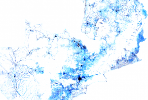 Facebook Connectivity Lab in collaboration with the Center for International Earth Science Information Network (CIESIN) at Colombia University combines machine vision AI with satellite imagery and census information to create population density maps. With the integration of demographic information, specifically related to age and gender, these maps collectively provide information on both the location and the demographic of a population in a certain country. The population density maps cover the majority of countries around the world.Publishing institution:
-
Facebook Connectivity Lab in collaboration with the Center for International Earth Science Information Network (CIESIN) at Colombia University combines machine vision AI with satellite imagery and census information to create population density maps. With the integration of demographic information, specifically related to age and gender, these maps collectively provide information on both the location and the demographic of a population in a certain country. The population density maps cover the majority of countries around the world.Publishing institution:
Term Parents
UN-SPIDER Regional Support Offices with hazard-specific expertise
![]()