The UN-SPIDER SpaceAid framework was triggered on 12 January 2010 for the devastating earthquake of magnitude 7 that struck Haiti. The massive damage to the local infrastructure in Haiti has made satellite images and maps vital to assess damage and plan the relief work. Those images can be used by humanitarian relief workers on the ground to for example identify accessible roads and suitable areas to set up relief facilities.
UN-SPIDER experts became involved in supporting relief efforts only minutes after the earthquake hit. Immediately, UN-SPIDER coordinated through its network with a vast number of providers of space-based information, value adding services and partners from the end-user community. UNOOSA, in close coordination with the UN DFS Cartographic Section activated the International Charter: Space and Major Disasters on behalf of the United Nations Stabilization Mission in Haiti, MINUSTAH.
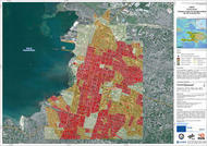
The main vehicle to support the international relief efforts for Haiti in terms of space-based assets is the SpaceAid section of UN-SPIDER’s Knowledge Portal. On this website, UN-SPIDER compiles, organizes and disseminates the latest available space-based information, including space-derived images, maps and related geospatial data of the affected areas. This information is continuously updated and made available to end users in the field as well as to the general public. UN-SPIDER will equally seek to play a decisive role in supporting recovery efforts after the early response phase.
SpaceAid Updates for Haiti earthquake:
This webpage provides the latest information on space-based assets to support disaster response efforts in Haiti. It can be accessed through: