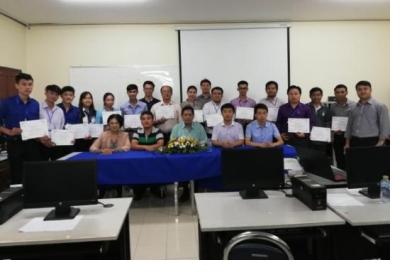
The National University of Laos (NUOL) and Deqing Academy of Satellite Applications (DASA) conducted a joint Asia-Oceania GEOSS (AOGEOSS) training workshop on Earth observation data for urban, agriculture and disaster monitoring in the Mekong Basin from 15 to 19 October 2018 at the Faculty of Engineering (FE) of the National University of Lao People’s Democratic Republic. The workshop was carried out in cooperation with the Institute of Remote Sensing and Digital Earth (RADI) of the Chinese Academy of Science (CAS) and Beijing PIESAT Information Technology Co., Ltd.
The Chinese delegation was led by Professor Qingyan Meng and Professor Xiang Zhou. The representative from the Faculty of Engineering was Professor Dr. Boualinh Soysouvanh, Dean of the Faculty of Engineering, National University of Lao PDR. Twenty participants participated in activities aimed at strengthening the capacity of Lao young researchers, teachers, students and officials from different institutions/ministries in using Earth observation, the BestCloud training platform and the remote sensing software PIE.
The workshop provided knowledge on AOGEOSS initiatives, Chinese satellite and data products, validation of the satellite remote sensing products, the BestCloud platform and hands-on practices focusing on Earth observation data for urban, agriculture and disaster monitoring using the BestCloud training platform available on the BestCloud Portal. The practices were taught as step-by-step procedures for obtaining, processing and mapping Earth observation data in use of the Best Cloud training platform and PIE software.
The workshop was a follow-up of the AOGEOSS work plan for this year. The same event was held on 18 September 2018 in Kathmandu, Nepal. It is planned to have the same event next year in Myanmar, Sri Lanka or Kenya. The workshop is committed to providing accessible education and training on Earth observation data and leveraging them for supporting urban planning, agriculture and disaster monitoring. Also, it aims to enhance international cooperation to Lao PDR and complement UN-SPIDER activities and national actions for the implementation of the UN Sustainable Development Goals by 2030.

