![]()
United
Nations
ACOLITE
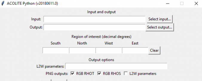
| Description: | ACOLITE is a processor for Landsat (5/7/8) and Sentinel-2 (A/B) imagery that includes pre-entered atmospheric correction algorithms. The software is specialized on coastal and inland water applications and allows e.g. to track oil spills and sediment flows or to monitor chlorophyll levels in water bodies in order to assess algae blooms. Developed by the Royal Belgian Institute of Natural Sciences, the processor can be used through a simple GUI or from the command line. The tool allows to extract rectangular regions of interest (defined by bounding coordinates), to calculate the reflectance derived parameters, and the generation of RGB images before and after atmospheric correction. The output products can be formatted as NetCDF datasets or exported as GeoTIFF and PNG images. |
| Software type: | Procesamiento de imágenes con computador de escritorio |
| Accessibility: | Solo instalación |
| Computer System: | Windows, MacOSX, Linux |
| Scope: | Procesamiento de imágenes |
| Vector/Raster: | Raster |
| Optical data or radar data format: | Óptico |
| Graphical user interface: | Sí |
| Costs: | Gratis |
| Tutorials: |
![]()