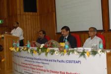
This training course was conducted as a follow-up action to the Technical Advisory Missions which were carried out by UN-SPIDER in Bangladesh, Sri Lanka and Myanmar. This one-month training course was organised by the Center for Space Science and Technology Education in Asia and the Pacific (CSSTEAP) and was jointly conducted by the Indian Institute of Remote Sensing of ISRO, UN-SPIDER, UNESCAP and UNU.
Space technology for disaster risk management and emergency response
The Indian Institute of Remote Sensing of ISRO, UN-SPIDER, UNESCAP and UNU
A total of 27 participants from 17 countries were participating in the course.
The overall objective of this international training course was to strengthen the capacity of participants in understanding how space-based information, services and solutions can be used to reduce disaster risks and losses. The participants were exposed to relevant space-based geoinformation (remote sensing, GIS, satellite positioning systems) and communication technologies and their synergies with modeling techniques that can be used in different phases of disaster risk reduction (DRR) for a variety of hazards. The course consisted of five modules including an overview of disaster risk reduction, an overview of space technologies for disaster risk reduction, the application of space technologies to this context and a short project.